

Maps, Maps, and more Maps!
Which map is my map?
On June 20, 2018 FEMA released a new Flood Insurance Rate Map (FIRM) for the Borough of Monmouth Beach. Follow these instructions to view a properties base flood elevation (BFE).
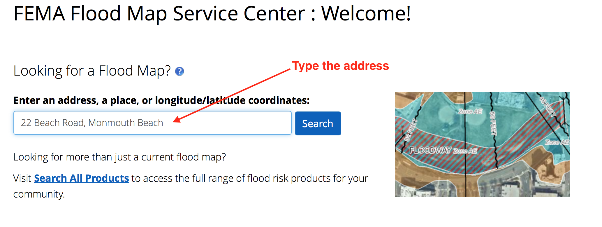
Here is how it works. Your current flood insurance policy is based upon the 06/20/18 Flood Insurance Rate Map (FIRM). The 2018 FIRM is your official “Flood Map” . When using these maps remember to copy the address you are searching, you may have to type it more than once.
Step One: Enter the address and click search.
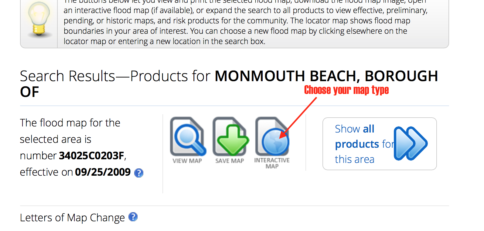
Step Two: Choose your map type.
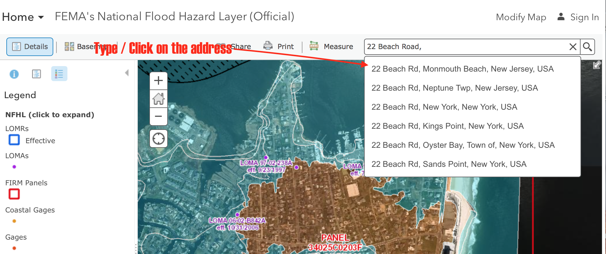
Step Three: Type the address again (the address will populate and you confirm the correct address).
Step Four: Choose your “Basemap” and then click on “Imagery”.
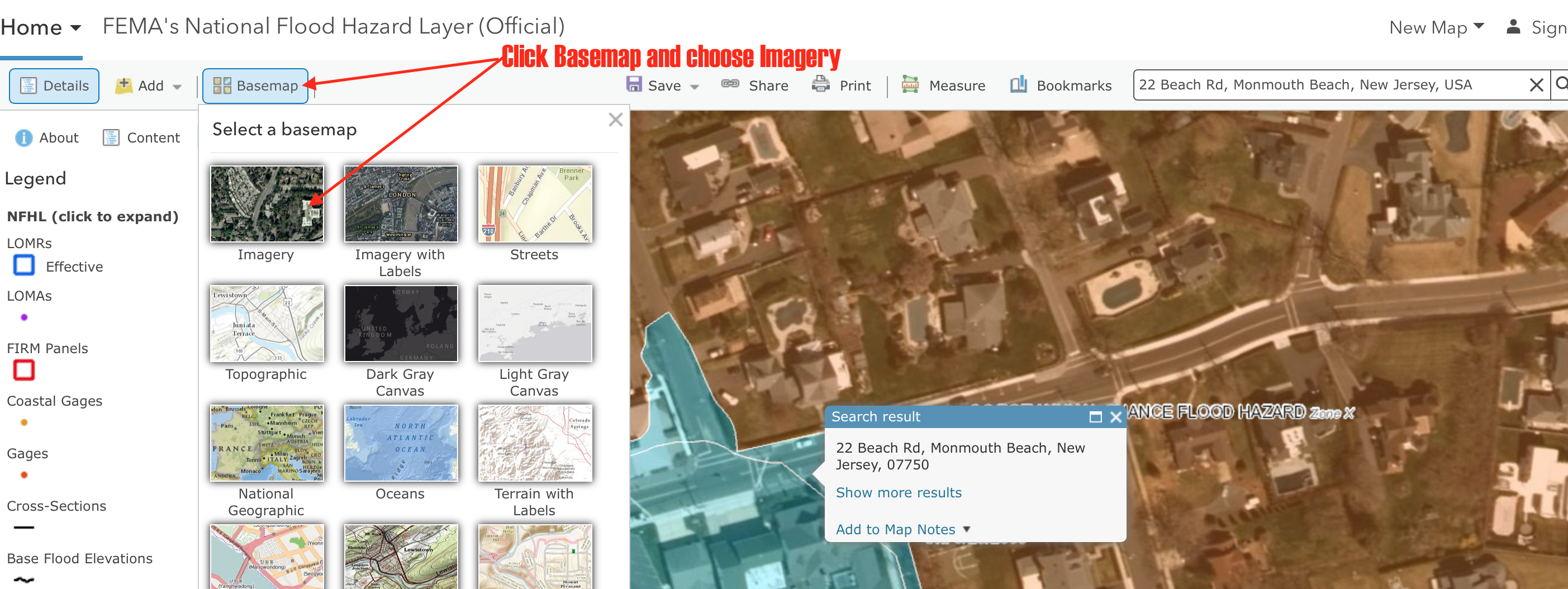
You are now ready to view the official FIRM!
Disclaimer: These maps are advance search tools and offer many different setting and options to choose from. It is not possible to tell how your computer will view the FIRM.
Another Map Option:
The following map option will not always provide information. This map option was not intended as a permanent map option but seems to have stayed available on a limited basis. In short, it will not always work. However, when available, can be very useful!
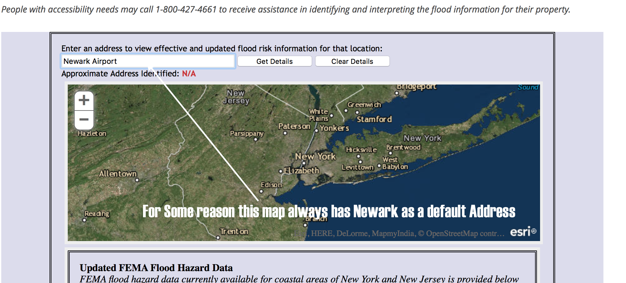
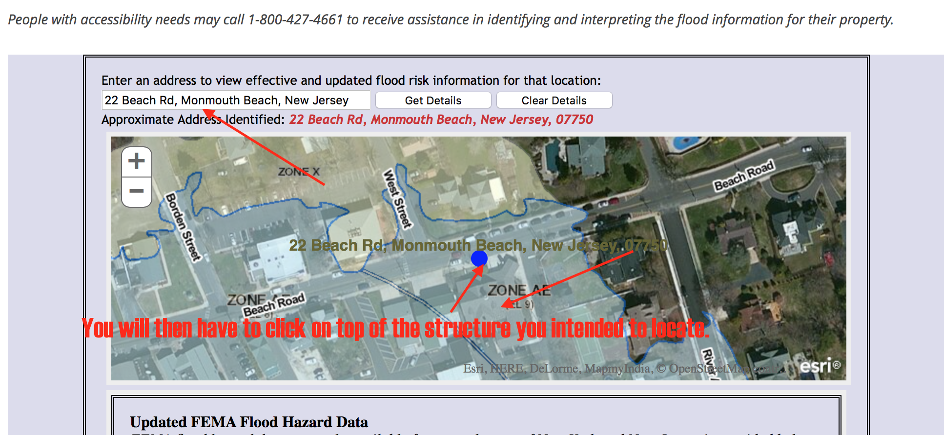
The Map known as What is My BFE you can find this map using any search engine such as Google or click here
This map has fewer step to follow.
Step one: Enter address
Step 2: Click on top of the intended address. The locator will most likely be in the middle of the road and not on top of the intended structure.
For more information on these maps in the Borough of Monmouth Beach contact Don Clare, Floodplain Manager at dclare@monmouthbeach.org or call 732-229-2207 Ext 1005.
Thank you,
Borough of Monmouth Beach